Quick Links
")
")
")
")
The map of Boston Logan International Airport (BOS) is a valuable tool for navigating, which is located just 5 miles from downtown. It plays a key role in connecting the Northeast region of the U.S.
However, the airport is renowned for being difficult to navigate, especially for people who live outside the city or are visiting the airport for the first time.
This essential guide provides key information on getting to and from BOS, parking amenities, and transportation options. It helps you make the most of your airport experience.
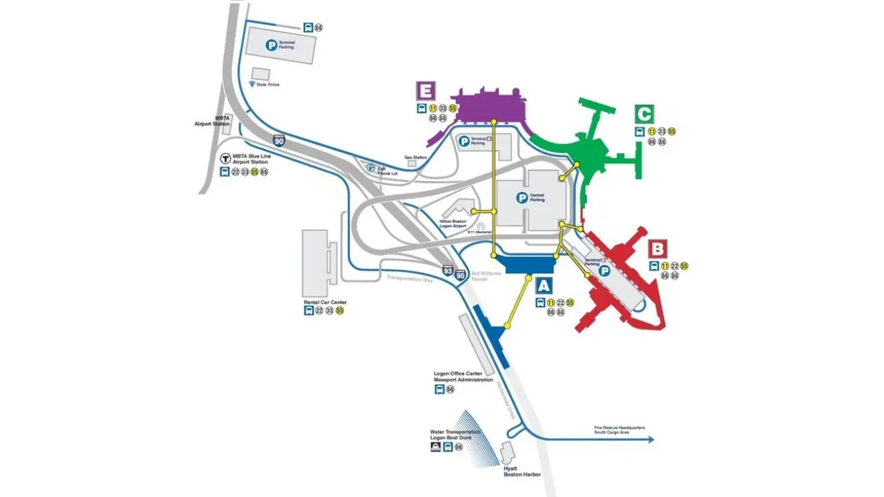
Map of Boston Logan International Airport (BOS)
Boston Logan International Airport's layout consists of four terminals, A, B, C, and E, arranged in a semi-circle, with roadways and parking facilities centrally located.
Each terminal features an automated security point. You can navigate to the security using the map and identify the relevant icons.
The map of Boston Logan International Airport (BOS) is a valuable resource for navigating the place, which serves as an important gateway for passengers flying to/from the Northeast region. Being a major international hub, it features multiple terminals where the interactive map can ease navigation, ensuring a seamless travel experience.
Besides, the airport features pet relief areas, multiple parking lots, accessible parking, and reliable transit options that meet the needs of every traveler. Use this guide to make the most of your time at BOS.